Hexagon - Citizen reporting & Geospatial Solution for COVID-19
CROWD SOURCING WITH THE MOBILE ALERT FOR EFFECTIVE COVID-19 RESPONSE.
The Coronavirus Disease 2019 (COVID-19) is threatening communities across the world. Getting information to the right person quickly can both protect and save lives. We are all in this crisis together, and it necessitates us working together in our communities. Communication between the general public and authorities is key but sharing of actionable information isn’t always easy. So, how can we fix that problem? We can empower citizens to contribute and enable authorities to act.
Citizens
Download – Install - Report
Incident Reporting
+ Illegal Gathering or violations
+ Blackmarketing of essential supplies
+ Lack of facilities & resources
Authorities
Notify – Validate - Act
Enforcement
+ Jurisdiction based notification
+ Real-time & accurate location
+ Validates situation on ground
Government
Diagnose – Predict - Prescribe
Reassess and amend
+ Holistic macro to micro stats
+ Target focus areas and hotspots
+ Decision making based on facts

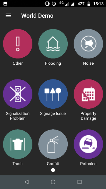
Customizable mobile application interface
Mobile Alert in FIGHT against COVID-19
Mobile Alert is a cloud-hosted solution, including the hosting environment, processing logic, and downloadable application. The application has two interfaces. One mobile application and another web based geospatial dashboard. The mobile application is free, available to everyone, and any smartphone with Android or iOS is enough to launch it. This can be freely downloaded from iTunes or Google Play Store. The Web based cloud-based platform that enables providing subscribers, such as law enforcement authorities and health department personnel, with field information or reports collected by the mobile application (civic CROWDSOURCING).
This application enables people to
+ Take photo of an area
+ Choose appropriate category
+ Write a comment
+ Enter Location (if GPS accuracy is poor, then Bing Maps can be used to pinpoint location)
+ Provide contact information for authorities to follow-up
Crisis Management
+ Location-Enabled Dashboards
+ Cloud-hosted solution
+ Local authorities
+ Common operating pictures featuring 2D and 3D
+ Integration with crowdsourcing citizen data
+ Deployable and Configurable remotely on-premise

